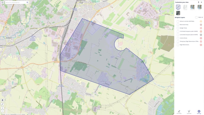
Airspace layers occluding the map
When entering a mission, certain Airspace layers containing air navigation data are displayed by default to promote safety. These display the potential risks and restrictions applicable to the zone of interest.
In areas where a lot of data overlaps, it may cause the map to be totally hidden behind the layers until such layers are removed from the view by deselecting all Airspace layers from the Settings panel.
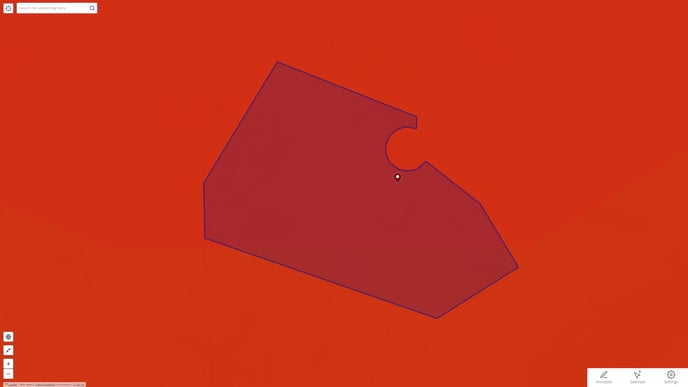
When an area is covered in red because of many restrictions and risks it is often more pratical to temporarily turn off the layers that cause problem.
This is performed by navigating to the 'Settings' menu and unselect the necessary layers.
All layers can be deselected at once by unchecking the 'Select all' check box.