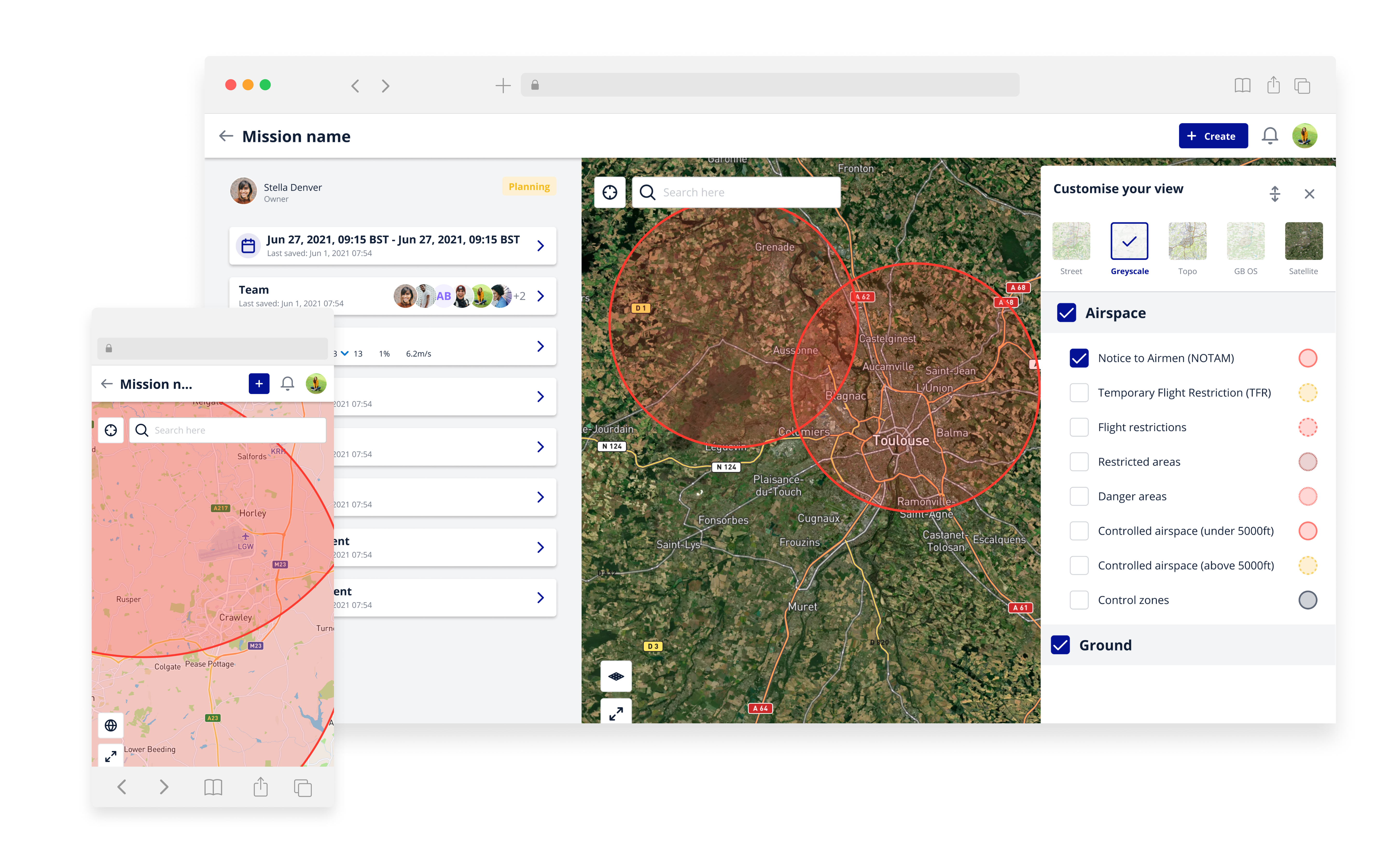
Our advanced maps give you access to precise, real-time data to help you plan your drone missions safely, efficiently and with confidence.
Get to know the terrain before you fly with street map, topographic and satellite layers, giving you full flexibility to plan your mission the way you want to.
3D Airspace Visualisation
Our advanced 3D airspace visualisation engine gives you a real-world view of the airspace surrounding your mission area. This enables you to review your mission’s interaction with airspace in proximity, making it easier to tactically assess the potential air and ground hazards around you.
Powerful Location Services with what3words
Find exact locations faster with our what3words integration. What3words assigns a unique and memorable three-word address to every 3m square in the world. Simply enter the three-word address to pinpoint the exact location on our map. It’s ideal for planning missions in more remote locations where traditional postcodes may be less relevant.
Quality and Accuracy Assured
Our UK maps are provided by Ordnance Survey, giving you the highest possible quality and accuracy of data.