In ScaleFlyt, there are multiple ways to find the geolocation of map features...
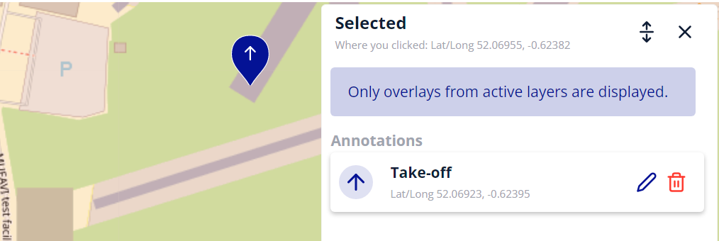
Whether you're looking for the geolocation of a specific place on the map or the position of your take-off, landing, or waypoint markers, ScaleFlyt gives you access to the Latitude and Longitude.
Geolocation of places on maps
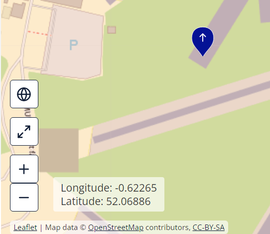
ScaleFlyt provides a convenient tool to dynamically display the Latitude and Longitude position of your cursor on the map.
You will find this tool in the bottom-left corner of the map.
Geolocation of markers on maps
ScaleFlyt provides accurate geolocation of the last place where you clicked and markers positioned on the map in the annotation tool.